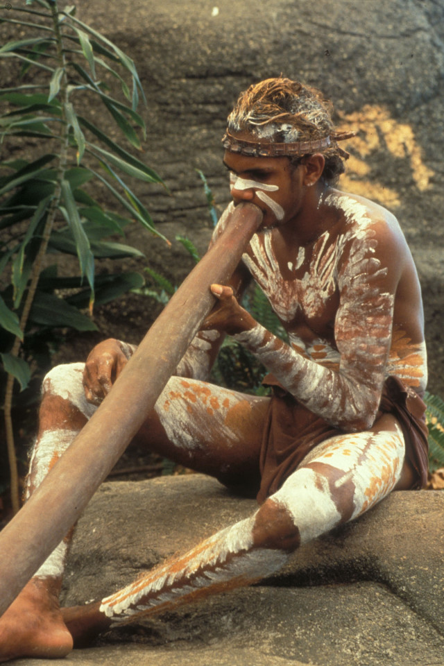
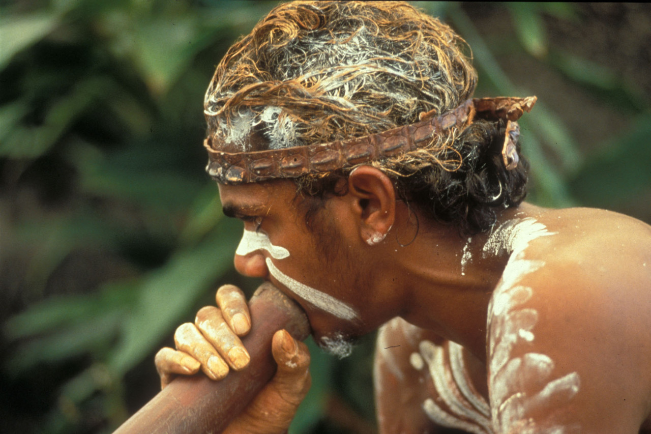
Australien: Ein Kukulanji Aborigines bläst ins Diggeridoo im Tjapukai Cultural Village nahe Cairns. A Kukulaji-Aborigines men plays the diggeridoo in the Tjapukai Village near Cairns.
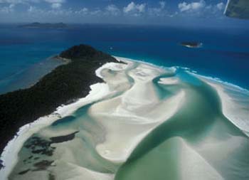
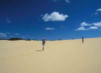
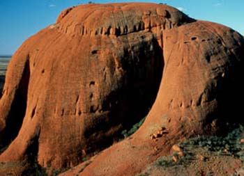
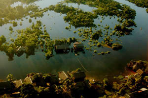
On the largest sand island in the world, tropical forested dunes rise up on the banks of crystal clear freshwater lakes in the midst of emerald green rainforests. Whales and dolphins frolic off the coast of Fraser Island. But the island biotope is not only a refuge for rare plant species and animals, but also homo ecotourism is increasingly nesting here. Up to 240 meters high sand dunes, 120 kilometers of beach and a sheltered bay, Hervey Bay is where whales cavort between August and October and they are the charm of the island’s microcosm.
Not only for geologists, botanists, nature, animal and bird lovers, but also for sailors, surfers and those looking for relaxation, Fraser Island offered paradisiacal conditions 20 years ago. In 2020, on the other hand, there were devastating forest fires and the ecosystem is a bit out of control, as in the entire Great Barrier Reef. The entire archipelago is suffering from global warming and oil and plastic pollution from tourists. Fraser Island is ancient, 123 kilometers long, 14 to 22 kilometers wide and has an eternity of over 220 million years of evolutionary history under its belt. Sand has been washed up and piled up on the island for two million years.
This landscape was formed in the Ice Age and has existed in its current form for about 6000 years. With the warming of the climate 140,000 years ago, the first traces of the Aborigines appeared there, but it is assumed that the «Butschulla» natives only settled on «KGari» Iceland 20 million years ago. For the western world, Fraser Island was discovered by James Cook in 1770. The gigantic fresh water reservoirs hold a total of ten to twenty million mega liters of fresh water. The crystal clear drinking water of Lake McKenzie, lined with bright white sandy beaches, is ideal for a swim. Dingoes can also be seen on the bank. But they don’t come to the watering place, but because of the tourists‘ bulging food bags. Many a nice bite for the wild dogs falls off. Even in the run-up to my trip to Australia, I campaigned for the “whaling ban” and reported on it in various newspapers, including the Sunday newspaper under the title “Better to cannibalize tourism than to slaughter”! Now I wanted to fulfill my dream and take part in a whale watch.
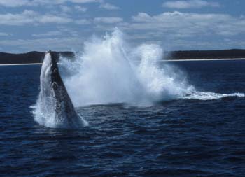
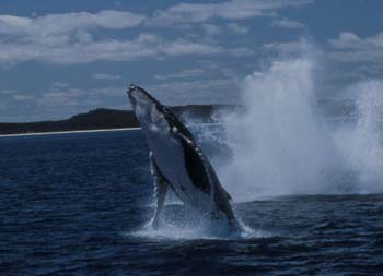
Hervey Bay is just one of a dozen places in the Great Barrier Reef where the whales frolic. Around 100 people jostle their way to the railing on the “Kingfisher” catamaran and search the horizon for fountains or a towering tail fin. “There they are,” shouts one and the crowd cheers! A colossus weighing perhaps 30 tons with a body over 16 meters long shoots up into the air like a silvery arrow, performs a pirouette and then plunges headlong into the water again. What a sublime sight! Fortunately, they are protected here. „Whale-watching“ has blossomed into a tourism branch worth 600 to 700 million in the 1990s. Whale watchers travel to Baja California, the coast of Brazil, Patagonia or South Africa to see the swimming mammals.
As early as 1994, Australia made over 50 million dollars a year from whale watching. No wonder, the giants of the seas are fascinating in every way! Their tones from the depths of the ocean sound like encrypted messages (today they are probably lamentations), similar to sonar, the echo sounder system of shipping, they determine their course with radar signals. They send out exact transmission intervals and with their sensitive instinct are able to pick up the signals of the sound waves again and to analyze and locate them precisely so that they can orientate themselves over thousands of kilometers. The chants, which last up to thirty minutes, are used to communicate with other members of the same species. From the turquoise shores of the Great Barrier Reef to a completely different area, which is in contrast to the maritime life, but also fights for survival.
The Northern Territories are the region to discover the culture of the indigenous people
The Northern Territories are the region to discover the culture of Australia’s indigenous people, a world of many contrasts between the green, tropical north and the red glowing heart of Australia, the Outback. Arnhem Land in particular is Aboriginal land and it borders Kakadu National Park to the east. More than 40 Aboriginal dialects are spoken here. Alice Springs is the second largest city and Darwin the seaside capital of the Northern Territories. The treasure trove of the aborigines, however, lies in Kakadu National Park, which is a Unesco World Heritage Site. Also famous are the hot thermal springs of Mataranka south of Katherine in Elsey National Park, where 30 million liters of water gush from the depths every day. Kings Canyon is Australia’s largest gorge and up to 300 meters deep. This grandiose microcosm, which ranges from rainforest to desert and from dreamlike beaches to the world’s most beautiful diving grounds, breaks all boundaries.
No wonder some people get infected by the Australia virus. Shortly before the „millennium“ I made another Australia trip of a special kind. For a lifestyle reportage, the best hotels, spa lodges and restaurants were on the menu. This led to the flagship of the Australian hotel industry „Hayman“ Island in the White Sunday Islands, then to the then newly opened „Palazzo Versace“ Hotel and then to the two luxury outback feeling „Peppers Lodge“ and „Spicers Peak Lodge“. On the way to this my off-road vehicle got on the wet nature and splinter road by an evasion maneuver due to jumping out kangaroos into the skid and into a barbed wire fence, which scraped over the whole hood, windshield and the roof, so that the brand new vehicle looked totally scratched and ready for the scrap but still drove. Only the totally scratched windshield clouded the driving fun. But it could have ended much worse.
But Australia has a big climate problem and that is the dependence on the coal industry. In the state of Queensland alone, there are over 50 of them and now, shortly before the 21st environmental summit in Glasgow, even one of the world’s largest mines, the Adani mine, is under construction but not yet in operation. Australia is the second largest exporter of coal and doesn’t give a damn about the targeted climate goals. Coal emissions account for 30 percent of CO2 emissions worldwide. This leads to long periods of drought, devastating bushfires, exceptional periods of heat, the earth glowing and boiling with rage at the fossil overexploitation and the harmlessness in exploiting the planet. The bushfires resulted in over a billion dead animals. Over half of the Great Barrier Reef is bleached and a giant coral graveyard.
Australia, Queensland, Daintree Eco-Lodge & Spa, Award Winner, Wjuulani-Aboringines,
Australien, Queensland, Daintree Eco-Lodge & Spa, eine der weltbesten Lodges
Aborigines, Ureinwohner, Regenwald, Sandsteinfarben, Körperbemalung
GMC/Daintree Eco-Lodge
Gold Coast, Surfers Paradies, Palazzo Versace Resort
Award Winner Daintree Eco-Lodge & Spa,
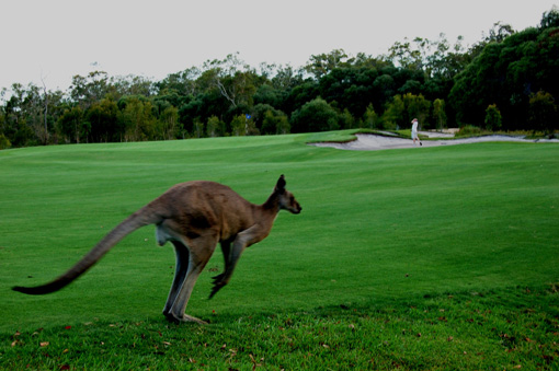
Australien: Pelican Waters Golf
Australien: Ein Kukulanji Aborigines bläst ins Diggeridoo im Tjapukai Cultural Village nahe Cairns. A Kukulaji-Aborigines men plays the diggeridoo in the Tjapukai Village near Cairns.
Aborigines playing Digeridoo.
A Kukulaji-Aborigines men in the Tjapukai Village near Cairns.
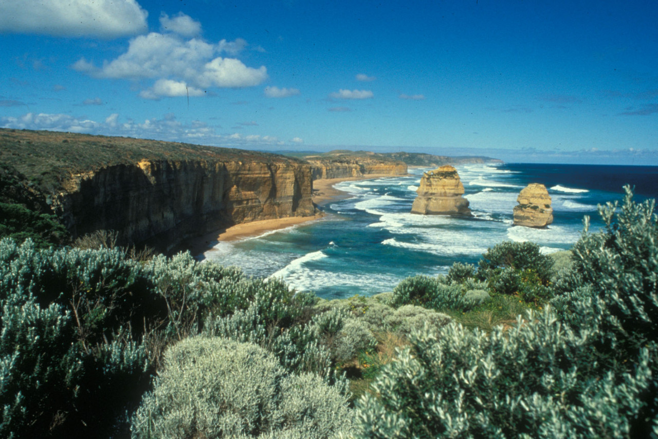
Great Ocean Road
The Grampians im Outback bei Coober Pedy
Daintree Forest Lodge at the Cape Tribulation in Queensland
French Polynesia: Helicopter flight and airshot from Bora Bora Island
FOREWORD
The author, Gerd MichaelMüller, born in Zürich in 1962, traveled as a photo-journalist to more than 50 nations and lived in seven countries, including in the underground in South Africaduring apartheid. In the 80 years he was a political activist at the youth riots in Zürich. Then he was involved in pioneering Wildlife & eco projects in Southern Africa and humanitarian projects elsewhere in the world. As early as 1993, Müller reported on the global climate change and in 1999 he founded the «Tourism & Environment Forum Switzerland». Through his humanitarian missions he got to know Nelson Mandela, the Dalai Lama and other figures of light. His book is an exciting mixture of political thriller, crazysocial stories and travelreports – the highlights of his adventurous, wild nomadic life for reportage photography .
(please note that translation corrections are still in progress and images will follow soon)
Australia: Aborigines and nature reserves
On the world’s largest sand island, tropically forested dunes rise from the shores of crystal-clear freshwater lakes amid emerald-green rainforests. Whales and dolphins cavort off Fraser Island’s coast. But the island biotope is not only a refuge for rare plant species and animals, but also for homo ecotourism. Up to 240 meters high sand dunes, 120 kilometers of beach and a protected bay, the Hervey Bay, where the whales cavort between August and October are the attraction of the island microcosm.
A legend of the Butschulla tribe about the history of evolution says that the Creator once sent the gods Jendigi and Gari to earth. They created mountains, rivers and lakes, and the goddess Gari insisted on staying on earth. So Jendigi transformed the goddess Gari into a beautiful island with over 40 lakes, so clear that Gari could see him in the sky. He also created animals and humans and taught them to reproduce. This is the story of the creation of Fraser Island, the world’s largest sand island, 120 km long and 25 km wide. Over the millennia, the sea has washed up gigantic sand dunes.
Not only for geologists, botanists, nature, animal and bird lovers, but also for sailors, surfers and recreationists, Fraser Island offered paradisiacal conditions 20 years ago. In 2020, on the other hand, there were devastating forest fires and the ecosystem is also otherwise a little out of joint, as in the entire Great Barrier Reef. The entire archipelago is suffering from global warming and pollution from oil and plastic waste from tourists. Fraser Island is ancient and carries the eternity of over 220 million years of evolutionary history on its back. Sand has washed up and accumulated on the island for two million years. During the Ice Age, this landscape was formed and in its present form it has existed for about 6000 years. With the warming of the climate 140,000 years ago, the first traces of the Aborigines appeared there, but it is assumed that the „Butschulla“ aborigines settled on „KGari“ Island only 20 million years ago. Fraser Island was discovered for the western world by James Cook in 1770.
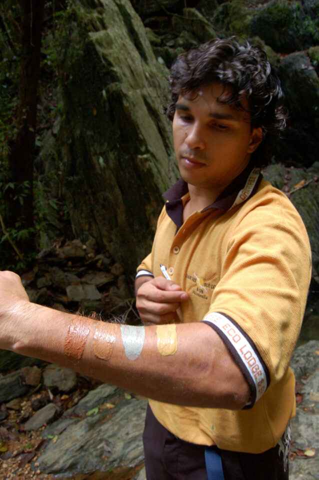
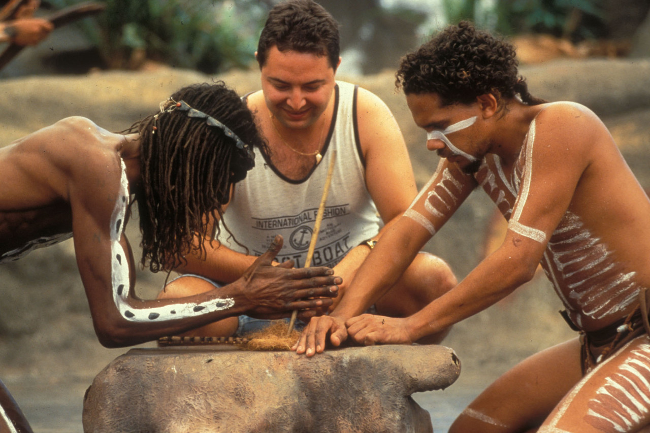
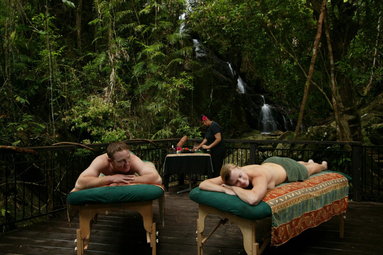
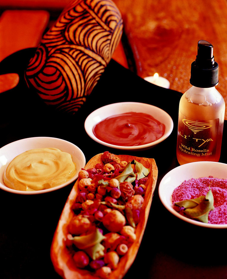
The gigantic freshwater reservoirs together hold ten to twenty million mega-liters of fresh water. The crystal clear drinking water of Lake McKenzie, lined with bright white sandy beaches, invites you to take a dip. Dingoes can also be seen on the shore. However, they do not come to drink, but because of the bulging provision bags of the tourists. Many a fine morsel falls off for the wild dogs. The starting point for many Queenslanders is the „Tapukjai Cultural Village“, where visitors are introduced to the culture of the local Aborigines. If you drive further north along the coast, you will first come to Palm Cove, a small charming nest, then you continue to Port Douglas, where the famous Thala Beach Lodge and the Daintree Forest Lodge, several times awarded as the most environmentally friendly accommodation in Australia. At the Wawu-Jirakul Spa (which means „cleansing of the spirit“ in the Aboriginal language), the five elements of earth, water, fire, air and ether are celebrated into a fantastic wellness cocktail amidst a waterfall in the jungle that served as a sacred cleansing kraal for the Kuku Yalanji Aborigines and a yoga site for Brook Shields. For the spa treatments, in addition to essential oils, various sandstones are used, which the Aborigines use not only for their body painting but also as food. The Aborigines walks with me around the spring, reaches into the loamy earth in three places and strokes a swab on my bare leg. Immediately I see that one strip is sandy yellow, the second clay gray and the third reddish. You see here we have zinc, copper and calcium mineral layers. „Once you run out of food,“ he says to me, „you flush the clay down with water, and that’s how you get minerals!“
Already in the run-up to the Australia trip I have made myself strong for the „whaling ban“ and reported about it in different newspapers, among other things in the Sunday newspaper under the title „Lieber touristy ausschlachten, als abschlachten“! Now I wanted to fulfill myself the dream and participate in a whale watching. Hervey Bay is only one of a dozen places in the Great Barrier Reef where the whales cavort. About 100 people crowd to the railing on the „Kingfisher“ catamaran, scanning the horizon for fountains or a towering tail fin. „There they are,“ one yells, and the crowd cheers! A colossus weighing perhaps 30 tons with a body certainly over 16 meters long shoots high into the air like a silvery arrow performs a pirouette and then dives headfirst back into the waters. What a sublime sight! Fortunately, they are protected here. „Whale-watching“ has blossomed into a 600 to 700 million tourism industry in the 1990s. Whale-watchers travel to Baja California, the coast of Brazil, Patagonia or South Africa to see the swimming mammals.
As early as 1994, Australia was earning more than 50 million a year from whale watching. No wonder, the giants of the seas are fascinating in every way! Like encoded messages (today they are probably lamentations) their tones sound from the depth of the ocean, similar to a sonar, the echo-sounding system of shipping they determine their course with radar signals. They send out exact transmission intervals and are able to pick up the signals of the sound waves with their sensitive sense and to analyze and locate them precisely, so that they can orientate themselves over thousands of kilometers. The songs, which can last up to thirty minutes, are used to communicate with conspecifics. From the turquoise shores of the Great Barrier Reef now to a completely different area, contrasting with the marine life, but equally struggling to survive. At the moment, only the Corona virus is more contagious. The east coast is considered an ideal entry point into Australia’s myth-enshrouded world. If you fly to Brisbane and from there straight up to Cairns, you can reach the rainforests at Cape Tribulation, the shores of the Great Barrier Reef, or take a boat from Brisbane to the evolutionary pearl of Fraser Island.
The Northern Territories are the region to discover the culture of Australia’s indigenous people, a world of many contrasts between the green, tropical north and the red glowing heart of Australia, the Outback. Arnhem Land in particular is Aboriginal land and it borders Kakadu National Park to the east. More than 40 Aboriginal dialects are spoken here. Alice Springs is the second largest city and Darwin the seaside capital of the Northern Territories. The treasure trove of the aborigines, however, lies in Kakadu National Park, which is a Unesco World Heritage Site. Also famous are the hot thermal springs of Mataranka south of Katherine in Elsey National Park, where 30 million liters of water gush from the depths every day. Kings Canyon is Australia’s largest gorge and up to 300 meters deep. This grandiose microcosm, which ranges from rainforest to desert and from dreamlike beaches to the world’s most beautiful diving grounds, breaks all boundaries.
No wonder some people get infected by the Australia virus. Shortly before the „millennium“ I made another Australia trip of a special kind. For a lifestyle reportage, the best hotels, spa lodges and restaurants were on the menu. This led to the flagship of the Australian hotel industry „Hayman“ Island in the White Sunday Islands, then to the then newly opened „Palazzo Versace“ Hotel and then to the two luxury outback feeling „Peppers Lodge“ and „Spicers Peak Lodge“. On the way to this my off-road vehicle got on the wet nature and splinter road by an evasion maneuver due to jumping out kangaroos into the skid and into a barbed wire fence, which scraped over the whole hood, windshield and the roof, so that the brand new vehicle looked totally scratched and ready for the scrap but still drove. Only the totally scratched windshield clouded the driving fun. But it could have ended much worse.
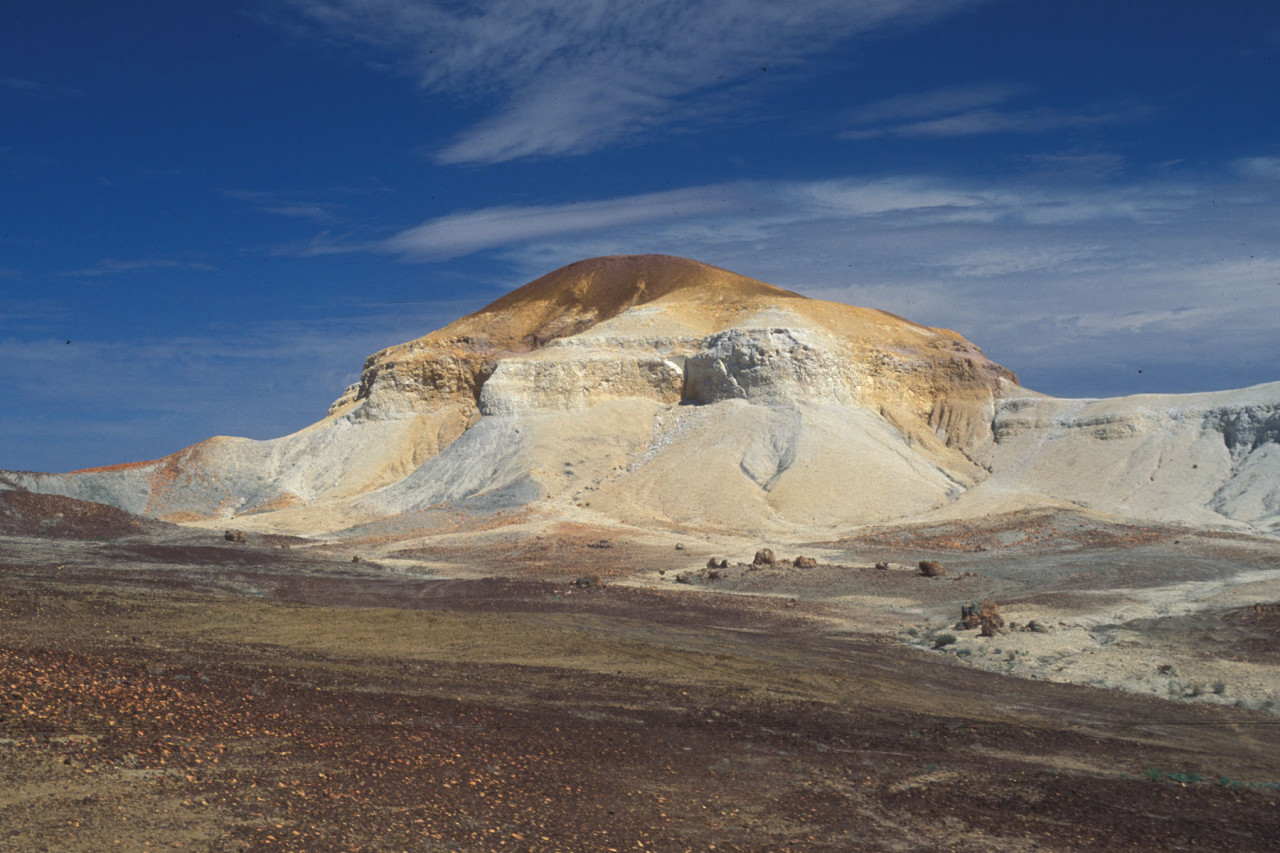
Opal seekers in Coober Pedy: Hope lives underground
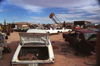
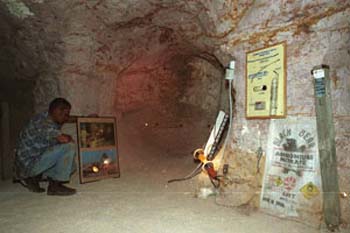
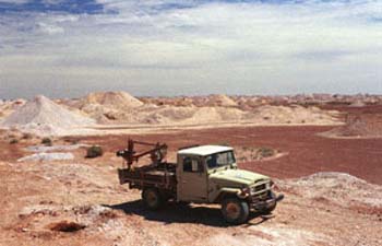
Between Adelaide and Alice Springs, somewhere in the middle of a glowing, hot, inhospitable lunar landscape, lies the then 5,000-strong nest of Coober Pedy, also known as „Opal Mining City“. The inhabitants live in subterranean mole-like constructions and also spend the day underground, in the tunnels, equipped with dynamite to carry out further blasting. Glimpses into the lives of opal prospectors in a dynamite-laden underground. Driven by the hope of quick riches and exposed to the risk of failing mouse-poor, real fortune seekers thus, from all parts of the earth. But what is it that draws people here? Desolation, scorching heat, lots of dust and rubble, and endless hardships. Nothing is spared the opa prospectors here.
Four-fifths of the population lives underground in the tunnels, which have ventilation shafts to the top. The supermarket, gas station and church are also underground. Here in the hot outback, men from Albania, Italy, Croatia, Greece, Serbia, Poland and even Swiss are among them. They are all looking for the precious stones. At that time, you could just stake a „claim“ and start drilling and blasting. Lucky men who left Coober Pedy as rich men are few and far between. The large cemetery in the desert nest is eloquent testimony to that. There is also a letter carrier for the region. John Stillwell’s oxen tour clearly shows the local dimensions. Twice a week, John drives from Coober Pedy to William Creek, a provincial nest of nine houses, and then to Oodnadata, a dilapidated Aborginies settlement, delivering mail to three farmers over the 650 kilometers. John has been doing this tour for six years now and he has done the route over 700 times.
We also crosses the Moon Plain Area, a dry, stony, sandy moonscape dotted with small hills to the Anna Creek cattle ranch, whose fence is over 9600 kilometers long. The farm is thus almost as big as the Netherlands. Then we continue to William Creek and although there are only nine houses, there is probably the most expensive satellite phone booth in the world and a shady parking lot with parking meter. We continue along an old Aborginies trail to the underground hot springs and follow the „Great Overland Telegraph line“. At sunset we played another round of desert sand golf.
South Sea Pearls: At the Gate to Paradise
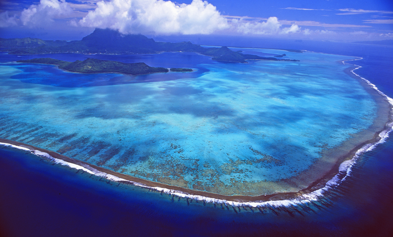
A mosaic of light and color surrounds the widely scattered chain of islands. Each of these islands, covered in emerald green vegetation, is fringed by turquoise blue and wreath-shaped reefs. They limit the depth of the sea, turn its opulent underwater splendor upwards and unfold the beauty of the colorful coral gardens with great abundance of species and shield the islands, which are often only a few meters above the sea surface, from the surf. After an interminably long flight from Zurich, via Paris, New-York, San Francisco and Hawaii, I landed at the „gateway to paradise“ on Tahiti – also called the „island of love“ and synonymous with the stuff dreams are made of. The French overseas territory with its 118 islands is divided into the Austral and Society Islands, the Marquesas and the Tuamotu Archipelago. The choice is difficult. But basically, there are two types of islands that unite to form a brilliant ensemble: high volcanic islands like Moorea, Huahine or Tahiti and flat atolls like Tetiaroa.
Tahiti, the „island of multicolored waters“ is also a symbol of the transfigured myth that covers the South Seas like its sparkling firmament with enchanting impressions. In the South Seas the creator once wanted to show what he was capable of, the poet Robert Brooke recorded. Gaugin, too, fell into a painterly impressionist frenzy of colors and senses. Especially Moorea, which is less than half an hour away from Papeete by catamaran, is taken to heart by many. The vacation island, on which several volcanic peaks rise like lances into the sky, became famous through Dino de Laurenti’s film „Mutiny on the Bounty“. Right next to the 900 meter high Mount Rotui lies the famous Cook Bay. Indeed, one cannot help but paint the South Seas in the most beautiful colors and praise it in the highest terms. In view of the gentle and strong charisma of the islanders, one is tempted to elevate their world to a paradise on earth. When graceful, strong men row their canoes through the water as swift as an arrow, or graceful creatures sit under the coconut palms, mango, papaya, avocado and breadfruit trees. Since then, Europeans have measured the South Seas with the yardstick of their wishes and dreams; poets of all stripes fantasize, fabricate and compose much crazy beauty. But a place of vicious pleasures, the South Seas is not, despite all matriarchal mores and permissive sensuality. But there is a conspicuous number of transvestites (raerae) in Papeete. And a Polynesian peculiarity are the marus – sons feminized from an early age by their mothers, usually the last born in a family that has no daughters. They behave like women and do the housework. Both marginalized groups enjoy a high level of social acceptance.
Thirty years after the French invasion of Tahiti and Mururoa by an army of nuclear physicists, engineers and military men, the South Sea Islanders know not only the god of love, but also the god and power of money. Life in paradise has its price and it is high. Problems with alcohol and other drugs as well as poverty and slumming are on the rise. In fact, travel writers can’t help but describe the South Seas in the most beautiful colors and, in view of the gentle and tranquil way of life of the extremely hospitable islanders, elevate it to the status of paradise.
High volcanic islands like Moorea, Huahine and Tahiti, flat atolls like Marlon Brando’s kingdom of Tetiaroa. Like Tahiti, Huahine is divided into a large and a small island. Between them is a strait that is very popular with surfers. Bora Bora has the most spectacular and beautiful lagoon in the world. Truly, the only 30 square meters small but 30 million years old atoll is a precious jewel in the Pacific. At that time, many tourists also took Moorea to their hearts because of the movie „Mutiny on the Bounty“, which was filmed there in Oponohu Bay.
Brazil: Amazonas Forest RIver Expedition with MS Bremen and scientists on Board.
FOREWORD
The author, Gerd Michael Müller, born in Zürich in 1962, traveled as a photo-journalist to more than 50 nations and lived in seven countries, including in the underground in South Africa during apartheid. In the 80 years he was a political activist at the youth riots in Zürich. Then he was involved in pioneering Wildlife & eco projects in Southern Africa and humanitarian projects elsewhere in the world. As early as 1993, Müller reported on the global climate change and in 1999 he founded the «Tourism & Environment Forum Switzerland». Through his humanitarian missions he got to know Nelson Mandela, the Dalai Lama and other figures of light. His book is an exciting mixture of political thriller, crazy social stories and travel reports – the highlights of his adventurous, wild nomadic life for reportage photography .
(please note that translation corrections are still in progress and images will follow soon)
Its name is a legend and sounds as exotic as the myth that surrounds it: the Rio Amazonas. It is the second longest and most water-rich river on earth, the one with the most tributaries, the strongest water discharge, the largest catchment area and the most enormous delta. In thousands and thousands of meanders, it flows majestically through the most diverse and opulent rainforest on earth, nourishing, watering and sustaining an immense diversity of fauna and flora, while being the lifeline of millions of people. The Spanish conquistador Francisco de Orellana was its first ambassador when he told the Western world about the largest river system after his advance into „the green hell“ around 1542; the German explorer Alexander von Humboldt was its most exciting reporter and cineastes surely remember the fantastic impressions of the movie „Fitzcarraldo“ with Klaus Kinsky in the leading role of the crazy and pissed-off opera fan.
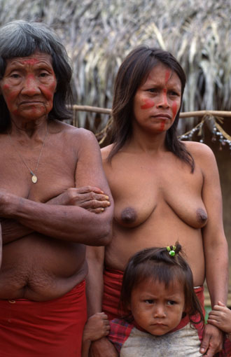
The Amazon is called „Maranhão“ by the Indians, „which only God can unravel“ and it consists of a bizarre network of over 1100 rivers, 20 of which are longer than the Rhine. But it is only after the encuentro dos aguas, the confluence of the Rio Negro and Rio Branco at Manaus, that the river is called Rio Amazonas. With its catchment area of more than seven million km2 and its daily deposit of three million tons of sediment in the delta, the Amazon outranks all other rivers. One fifth of the fresh water in the world’s oceans is fed by the king of rivers. More than 30,000 species of plants, which thrive on three levels above each other, and more than 2,000 species of fish and birds live in its catchment area.
An expedition to the Amazon jungle is both a journey into an exotic world full of overwhelming flora and an encounter with a species-rich fauna – full of giant snakes, such as anacondas and phytons, anteaters, sloths, howler monkeys, piranhas, shy river dolphins, colorful parrots (macaws) or magnificent tucans as well as nimble hummingbirds. The list could, it seems, be continued almost indefinitely. But the opposite is the case. The number of species threatened with extinction is increasing dramatically. According to experts, the rainforest is irretrievably destroyed when 40 percent of its area has been destroyed. In the last 50 years, a quarter of the rainforest has already been cut down or burned – with catastrophic consequences for the climate, the environment, people and animals. The indigenous people in the rainforests had destroyed barely one percent of the rainforest over the period of the last 15,000 years. A single human generation is therefore sufficient to throw the entire ecosystem of planet Earth out of balance and humanity as such into danger.
In Brazil today there are still about one million square kilometers of Amazon rainforest, which is not protected and not zoned but also does not belong to the indigenous tribes living there (because they first have to prove their centuries-old legitimacy in lengthy processes), so that their land is not sacrificed to overexploitation and investor rapacity. Because the common principle goes as follows: Areas are illegally confiscated, burned or cleared and thus destroyed. In the years that follow, attempts are then made to legalize land grabbing in this area through lucrative cattle ranching, which, at the latest since President Bolsonaro, is a piece of cake. Land speculation is fueled by international investors. In the region, some 30 billion U.S. dollars will be spent in the next few years on road construction, electricity and infrastructure to develop and exploit the primary forest. 92 dams are planned in the Amazon region. These are devastating prospects. What a capitalist madness.
To make matters worse, Jair Bolsonaro’s government is planning to build a railroad almost 1,000 kilometers across the jungle and many indigenous protected areas. The agricultural lobby is delighted, as the Ferrogrão infrastructure project promises lower transport costs to the Atlantic in the future and thus higher profits. This fuels further clearing of virgin forest with disastrous consequences: A study by economists Juliano Assunçao, Rafael Araújo and Arthur Bragança has shown that this is likely to result in additional clearing of an area of 2050 square kilometers, equivalent to around 300,000 soccer fields. Not only would the clearing of this virgin forest produce about 75 million tons of carbon, but the increasing loss of the green lung will soon lead to the collapse of the climate and irrigation system in the entire Amazon basin.
Where there is forest now, there is a threat of cattle breeding, soy plantations and then desert. „The less contiguous rainforest there is, the less the cycle of moisture absorbed in the Amazon basin and rainfall on the slopes of the Andes works,“ confirms the renowned Amazon ecologist Lovejoy of „George Mason University“. He is also of the opinion that the „Tipping Point“, the time at which the collapse threatens, is threateningly close. The renowned „Nature Magazine“ concludes that the rainforest is already so damaged that it emits more CO2 than it absorbs. This will have a catastrophic effect on fauna and flora in all Amazon regions. The next ten years will determine whether we destroy the Amazon refuge and lose it forever. However, the prospect of turning away from deforestation and exploitation and rethinking seems minimal. A sad story resp.a true nightmare for the global climate, fauna and flora. Because:
The Amazon rainforest consumes more carbon dioxide for photosynthesis than any other area in the world. By binding moisture, tropical rainforests form the largest freshwater reserve in the world. When they no longer exist, evaporation effects increase and precipitation goes directly into the open ocean, causing drought and dryness. The reduction of forest cover increases the carbon dioxide content in the earth’s atmosphere, which in turn also fuels the greenhouse effect. Rainforests should also not be underestimated as oxygen producers. After the phytoplankton in the sea, they produce the most oxygen. On the other hand, they bind large amounts of CO2 through photosynthesis. The burning of fossil fuels and slash-and-burn agriculture exacerbate the problem.
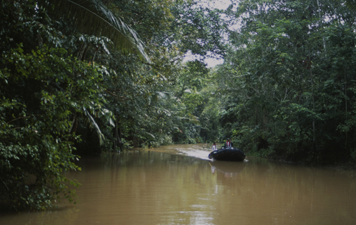
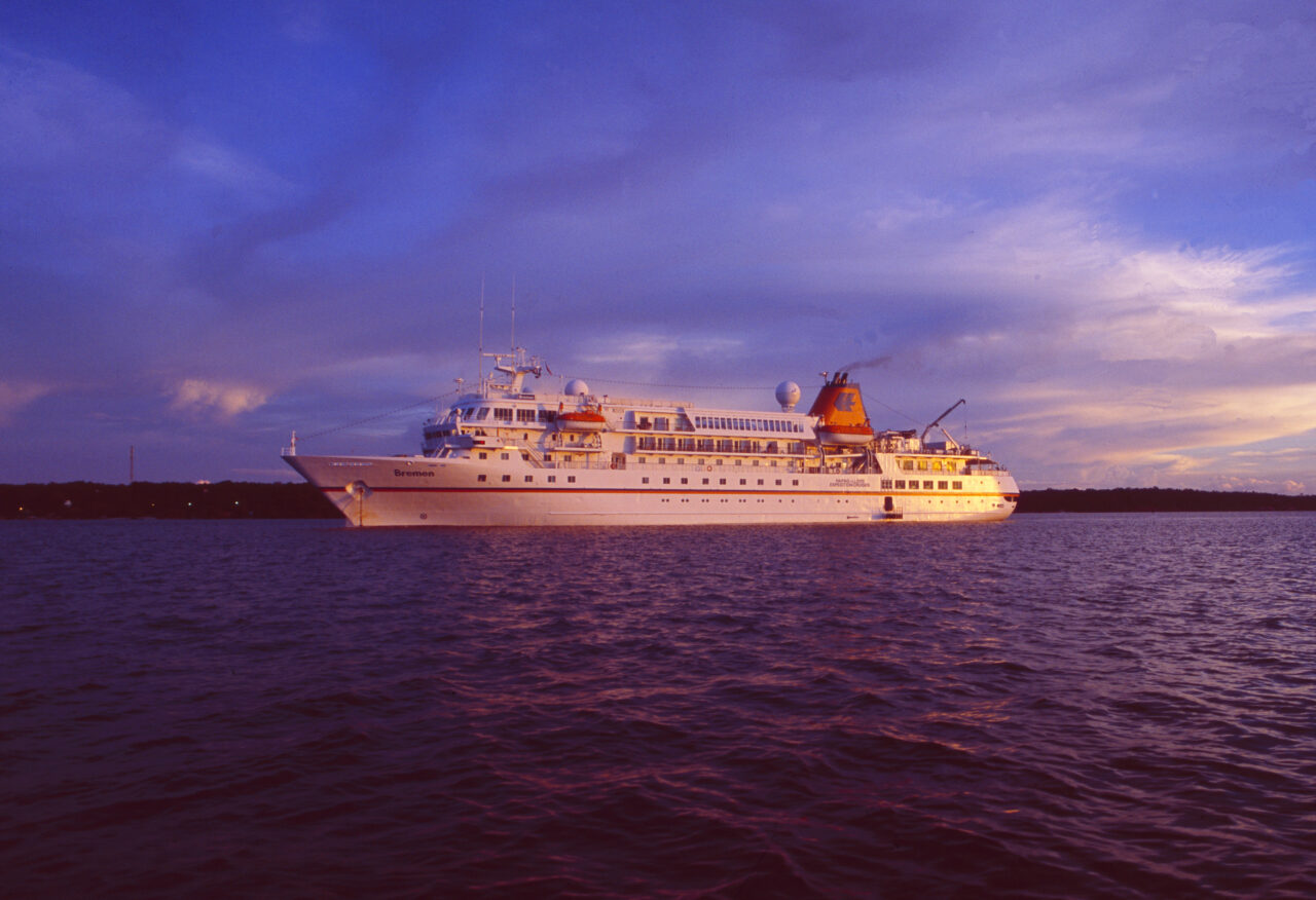
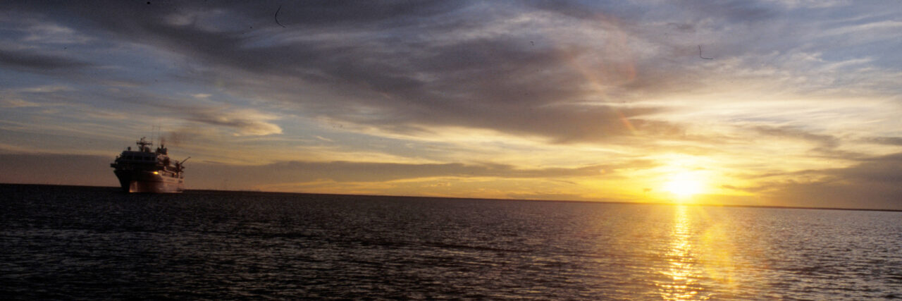
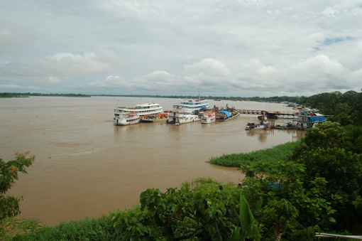
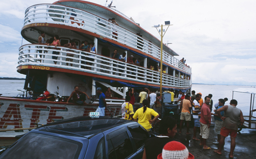
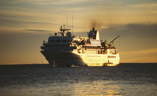
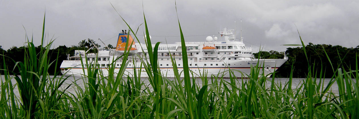
One of the most comfortable and at the same time most exciting ways to explore this opulent natural wonder and sophisticated ecosystem is a cruise, as you can do for example with the „MS Bremen“ – the expedition ship of „Hapag-Lloyd“ Cruises or the Hanseatic, another cruise ship of the Hamburg shipping company. There the otherwise rather laborious, sweat-driving and dangerous Amazon expedition becomes the light-hearted high pleasure. Although it is a bit grotesque to go on an expedition in the Amazon basin with environmental scientists on a CO2 pollutant, I decided for once to go on this, my first and only cruise. But due to a scheduling error, the „MS Bremen“ had left the Peruvian Amazon metropolis of Iquitos – a 400,000-strong provincial town that is very poor, but has countless casinos with slot machines and gaming tables – hours ago without me. Now I stood there and tried for three days to charter a boat to follow the luxury liner.
It finally took a whole week until I finally arrived with small speed boats in Manaus, Brazil and finally caught up with the „MS-Bremen“ after 1000 km of wild boat trip through the jungle. On the adventurous boat trip a backpack was stolen from me and the border crossing from Peru to Brazil was not without its problems either. We arrived at the border in the darkest of nights. On the spot there was no hut to sleep. On the other side in Brazil there was. Two fellow travelers and I found an old man who drove us across the border river in the pitch dark and picked us up again in Brazil the next morning to take us back to Peru, since we had to make an orderly border crossing and needed an exit stamp to avoid arriving illegally in Brazil. After the operation orderly border crossing had succeeded so far and I thus six days later than planned, burned as well as at the end of my forces on board the „MS Bremen“ had arrived, I relaxed first of all on the luxury steamer and was fed truly deliciously and exotically. Not only culinary but also with exciting jungle excursions, valuable information and super lectures about the respective region, its fauna and flora – garnished with finest appetizers, fantastic buffets and high-level entertainment.
The „MS-Bremen“ offers everything an explorer’s heart desires: a 100-strong crew, perfectly attuned to each other, who always strive to fulfill the passengers‘ every wish and make them happy with small attentions. Also the cruise ship offers a large selection of possibilities for the varied organization of the days on board with most diverse individual activities. Excursions with the high-horsepower inflatable boats allow access to otherwise inaccessible regions and therefore also offer a very intense perception of all the mysterious, exotic places and encounters with fauna that can be experienced from an impressive proximity. And thanks to the scientific speakers on board, you will learn more about the ecological and economic relationships between exploitation and exploitation.
Thus the ship journey runs over a good 1700 kilometers via Pevas down to Leticia in the border triangle of Brazil, Peru and Colombia and into the realm of the drug barons and smugglers. In the upper Amazon region on the Rio Negro and Rio Tabajos, the expedition guests are guided comfortably and safely by the Zodiac’s of the mother ship into the surrounding water veins of the largest river basin in the world. Scientists accompany the excursions and explain the lush wilderness and the species-rich fauna and flora to the cruisers. Thus, the complex puzzle of biological, geological and meteorological influences slowly comes together to create a multi-faceted picture of this fantastic ecosystem.
Just after Manaus, the two great jungle rivers Rio Negro and Rio Solimoes come together. From the air it looks like two giant anacondas entwining. Only after the union of the two rivers, the encouentro das aguas, the atlas allows the official name Rio Amazonas. They leave behind numerous side arms, pools and biotopes to the left and right of the main artery. In these refuges, clouds of colorful parrots soar, kingfishers dart nimbly across the water, and howler monkeys compete in the branches of the tennis-court-sized treetops. For the jungle giants, such as the para rubber, wool, Brazil nut or kapok trees grow 40 to 60 meters high and claim most of the sunlight for themselves and for the photosynthesis that breathes their breath into the world. In the shaded floors below, palms, myrtles, laurel, cedar and the coveted mahogany trees thrive. These, in turn, provide habitats for other plants, especially all kinds of epiphytes that vegetate without roots in the soil as parasites in the barks of their fellow species.
The next stop of the „MS Bremen“ is in Paritins. Every year at the end of June, the city on the river island is transformed into a seething witches‘ cauldron for three days. That’s when the biggest Amazon party begins – a spectacle that resembles carnival. Fantastic costume creations almost as tall as a house parade through the streets: Dolphins the size of ships, giant wild boars, snakes, feathered creatures and mythical creatures can be admired during the dance and musical spectacle. In addition, feather-clad prima ballerinas and scantily clad river nymphs twist and turn in the glow of the colorful lights. Also the singers, musicians and the audience let their strong, half-naked bodies twitch ecstatically to the drum rolls and sounds of the Sertaneja music. Of course, the caipirinha (sugar cane liquor) also flows in streams and clouds of marijuana are in the air. Up to 250,000 visitors from all parts of the Amazon region flock to Paritins on dugout canoes, yachts and Amazon ships through the numerous river courses. The climax takes place in the Bumbodromo, the amphitheater set up on the riverbank especially for the show. Up to 35,000 people then rub up against each other, sweating to the point of orgiastic delirium.
After this in-depth insight into the Brazilian cultural scene, the cruise continued via Santarem to the Brazilian seaside resort of Alter do Chao on the Rio Tapajos, which offers guests a wonderful bathing excursion on the headland between the two arms of the river. As the MS Bremen departs from here at sunset, the last part of the Amazon River cruise also begins overnight, as the delta is reached and the sea is in sight. Now the ship sets sail for the high seas with the destination of French Guiana, where Europe spills into the green hell of the Amazon and the most exotic Europeans live. The crossing was calm, the sea smooth as glass and the horizon endless. For the first time I arrived in Havana on a cruise ship and passed the skyline of the Malecon and that is quite a different, sublime sight and a new form of greeting on the sugar and tobacco island. Much better than the view of the bay from the fortress opposite. Now we leave Latin America and head for Asia. Let’s see what exciting things there are to experience.
Brasilien/Amazonas-Schifffahrt: eine Kreuzfahrt mit der MS Bremen bei Sonnenuntergang im DeltaBrasilien, Amazonas, Paritins, Schule, Schulkinder, Erziehung, Bildung, Schulklasse, Theater, Lehrer, Elterntag, Schiffsreise, Flussfahrt, MS Bremen, Hapag Llyod, Abenteuer,
Brasil, Amazonas, River, Paritins, Schoolkids, education, kids, theater, show, people, parents,
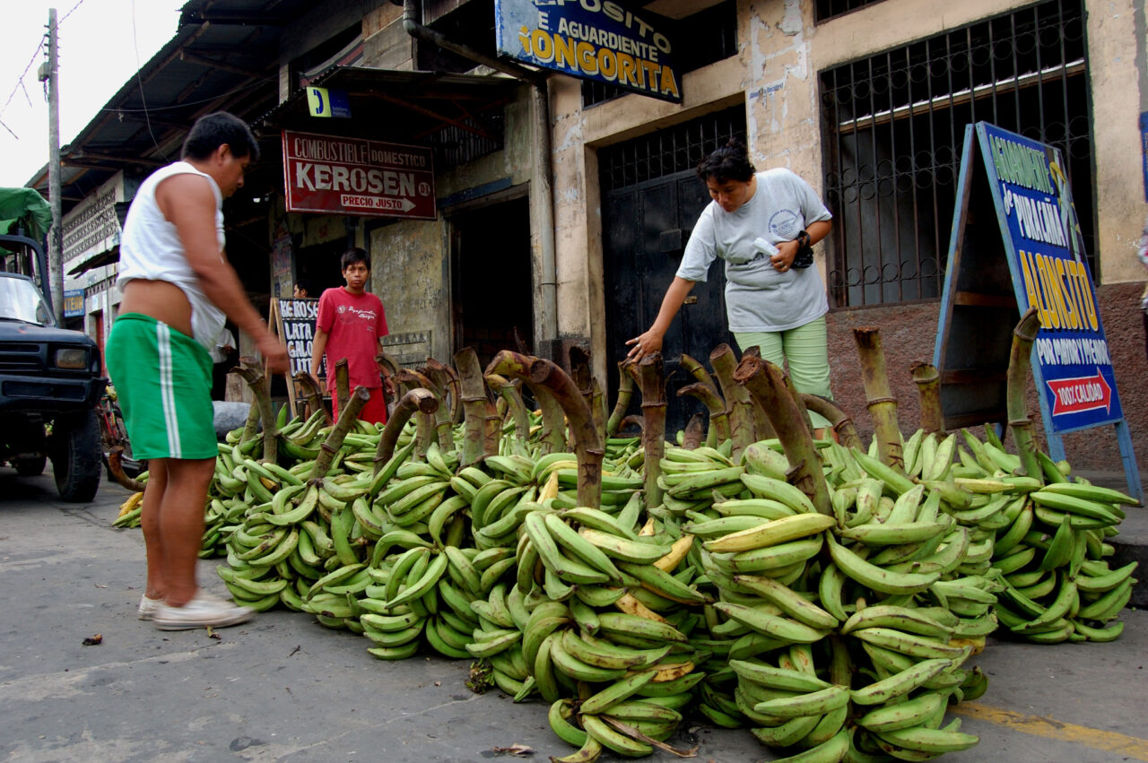
teacher, River-cruise, Hapag Llyod, MS Bremen,Peru, Amazonas-Departement Loreto, Stadt Iquitos, Belen,Hafenquartier, Strassenhandel, Markt, Personen, Verkauf, Handel, Armut, Früchte, Gemüse, Verkehr, Bananen
Peru, Amazonas-Department Loreto, Iquitos-City, Belen near the port, streetmarket, trade, people, nutrition, food, poverty, vegetable; fruits; bananasYagua-Indio’s am Amazonas im Dreiländereck, Kolumbien, Brasilien, Peru, Amazonas-River, indigenous people,Die Zerstörung des Primärwaldes hinterlässt gravierende Spuren im gesamten OekosystemIcebreaker-ship MS Bremen on the Amazonas-RiverBrasilien: Amazonas bei Tabatinga 80Brasilien; Manaus Hafen, Personen, Warenverlad | Manaus harbour, people, boatAmazonas: MS BremenBrasilien: Opera Manaus 121260px Header MS Bremen Amazonas
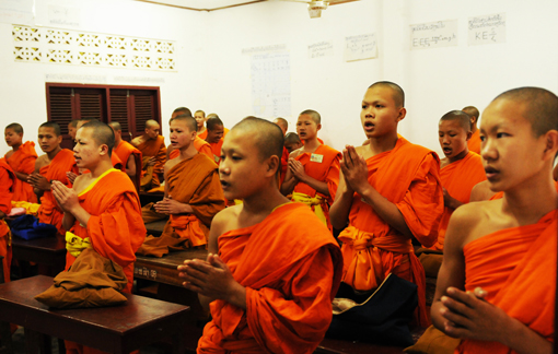
Laos: Around 2000 Monks are collecting food in Luang Prabang every early morning
FOREWORD
The author, Gerd MichaelMüller, born in Zürich in 1962, traveled as a photo-journalist to more than 50 nations and lived in seven countries, including in the underground in South Africaduring apartheid. In the 80 years he was a political activist at the youth riots in Zürich. Then he was involved in pioneering Wildlife & eco projects in Southern Africa and humanitarian projects elsewhere in the world. As early as 1993, Müller reported on the global climate change and in 1999 he founded the «Tourism & Environment Forum Switzerland». Through his humanitarian missions he got to know Nelson Mandela, the Dalai Lama and other figures of light. His book is an exciting mixture of political thriller, crazysocial stories and travelreports – the highlights of his adventurous, wild nomadic life for reportage photography .
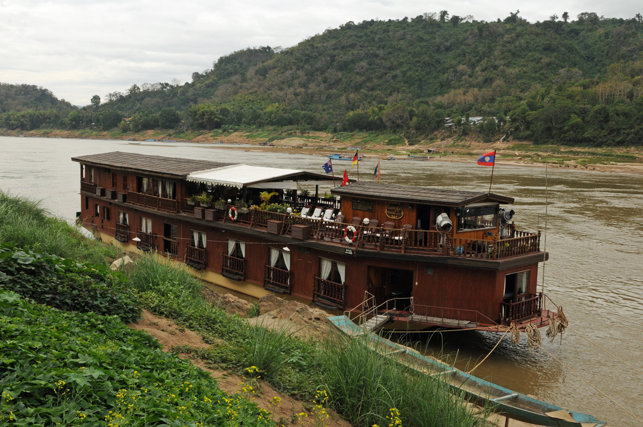
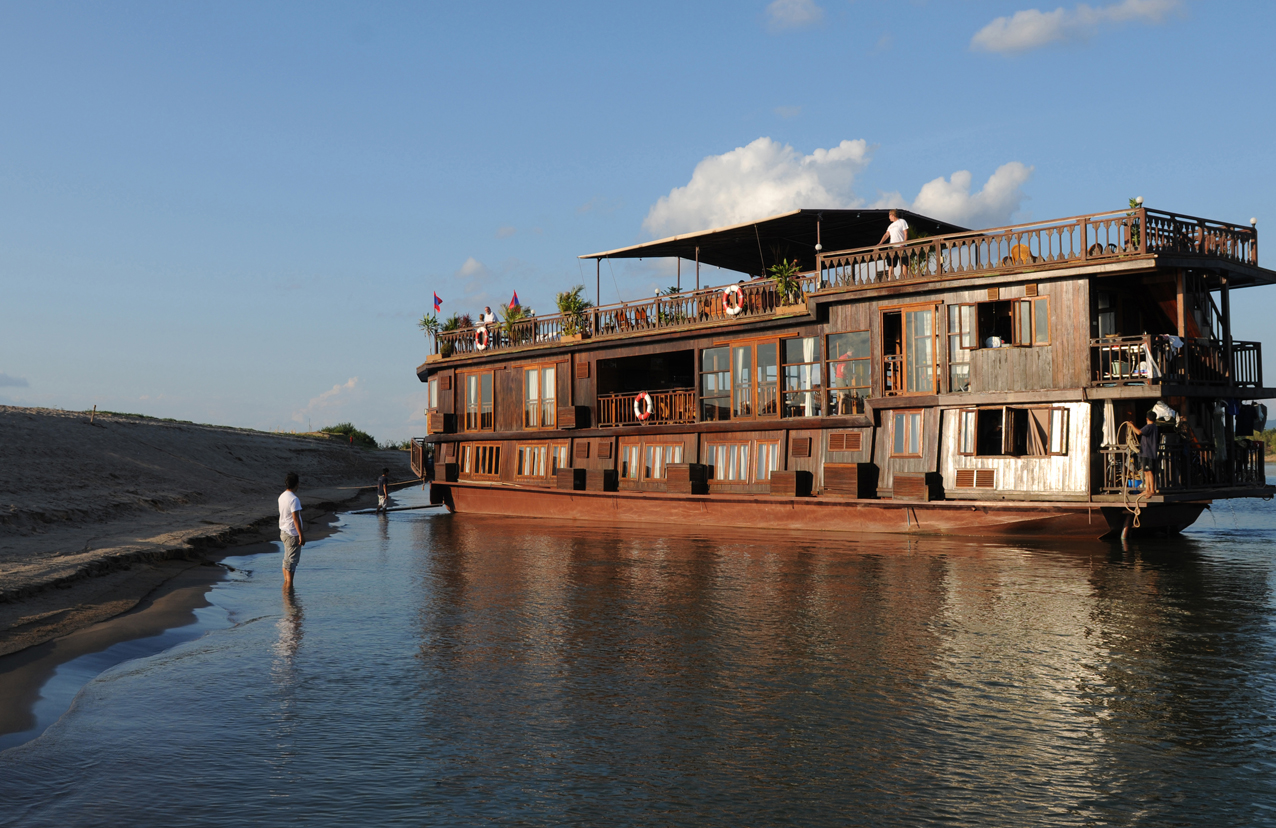
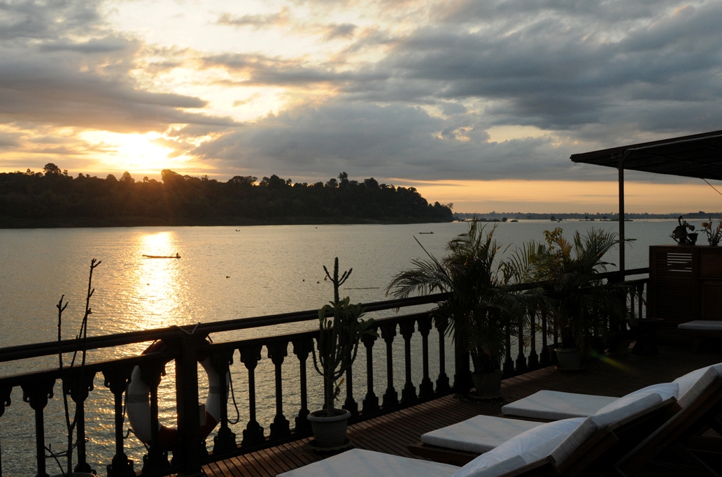
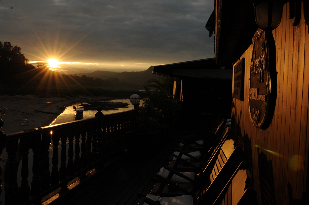
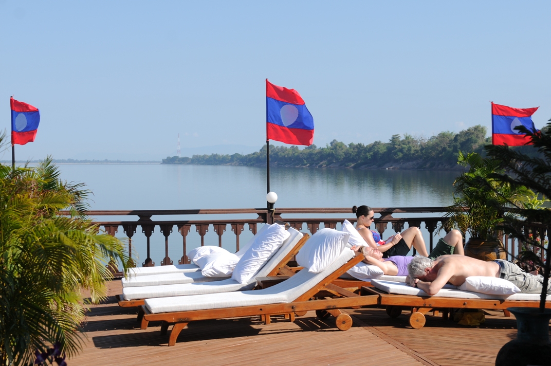
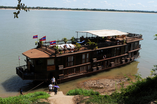
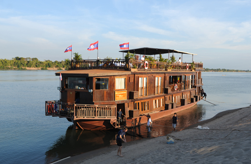
First it shoots through the multifaceted jungle face and bizarrely rugged riverbed landscapes, then it meanders another 1000 kilometers through rice-growing flatlands and finally fans out into a delta with 4000 tropical islands. The Mekong is the lifeblood of Indochina and the pulsating lifeline for seven million Laotians. What could be more natural than to explore the charms of Laos on a hotel boat and to drift downstream, contemplating the hustle and bustle of Laotian life. To slow down from the hustle and bustle of everyday life, to look calmly over the iridescent green tones of the jungle or to glide over the shining company-ment and to let the soul dangle.
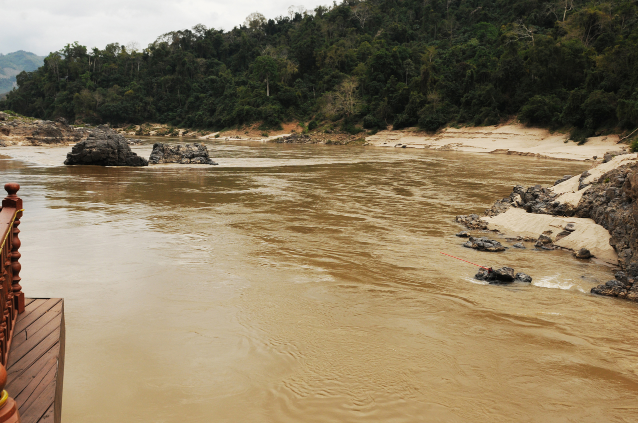
A trip on the Mekong River near the Golden Triangle is still an adventure today and just as exciting as it was in the days of the first Western explorers, the Frenchmen Lagrée and Garnier, who took two years for their expedition (1866-68). They were still struggling up the river in small outrigger boats against the wild rapids. Numerous jagged rocks, huge sandbanks, rocky gorges, narrow bends and the strongly varying water level, which can rise by several meters within hours, require extreme caution and precise knowledge of all dangerous places from the ship’s captains. At night, the upper reaches of the Mekong River are closed to navigation. It would be too dangerous in the darkness on the river. These are the pitfalls in the dry season. In the rainy season, on the other hand, the river swells rapidly by up to 20 meters.
Then logs weighing tons often shoot downstream at breakneck speed. Even on our short trip, the water level rose by three meters within two days. This was due to heavy rainfall in China and the opening of a dam. No wonder the upper course of the Mekong is one of the most beautiful but also one of the wildest river upper courses in the world. Our captain manages indeed, and sometimes resembling a small miracle, even on the way back downstream in the wake of the rapids, to curve around all the dangerous cliffs and skillfully weave through the narrow passages with the jagged rocks. In the dry season, the bizarre rocky outcrops rise up to above the deck of the boat. In the rainy season, they disappear below the surface of the water.
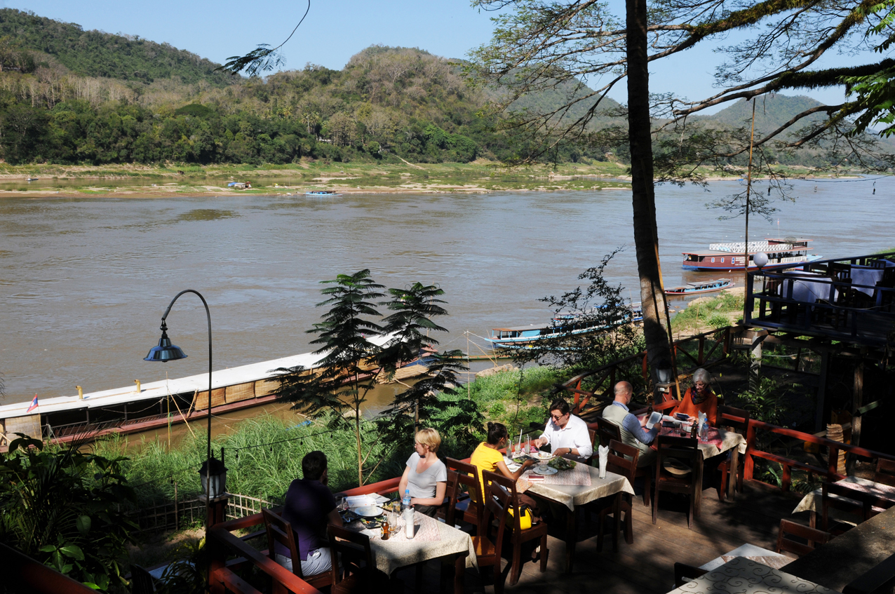
The river trip begins in the cultural heart of Laos, in the historic center of the city of Luang Prabang, which is situated in the protection of the spur between the Mekong and its tributary Nam Khan in northern Laos at an altitude of about 300 meters and is a trading center for rice, rubber and teak wood and handicraft products made of wood, textiles and paper. Since an international airport was built here, it is also the starting point for tourists coming from Vietnam or Bankok. The number of tourists in the old royal city of Laos is manageable. Between the many backpackers mingle more and more jetsetters who want to see the quiet beauty of Luang Prabang before it gets loud and crowded as in Cambodia or Vietnam.
In 1995, Luang Prabang was declared a Unesco World Heritage Site. 32 Buddhist monasteries and all of the French colonial architecture in the city were listed and have since been restored. Restrictive urban planning is also in place to prevent violations of the unique art-historical character of the city center. Luang Prabang’s urban history is inextricably linked to the history of Laos‘ origins. The political decline of the Sukhothai kingdom in northern Thailand in 1345 and the shift of the political center in Siam to Ayyuuhaya in 1351 also accelerated the need for a political unification process east of the Mekong River. 1365 is generally cited as the founding year of Lang Chang (the Land of a Million Elephants) under Fa Ngum. As a vassal of the Khmer Empire, Fa Ngum had received the Buddha statue Phra Bang as a coronation gift from Angkor. This was venerated in Luang Prabang, which was the capital of the kingdom of Lan Chang between 1354 and 1560, as a sacred statue with a function of legitimizing the rule.
Around 1356, Luang Prabang became a place of pilgrimage for the Phra Bang Buddha statue. Under King Setthatirat, many Buddhist monasteries were built in Luang Prabang in the 16th century. In the course of the Buddhist missionary work, among others, Wat Pasman was built on the site of today’s Wat That Luang as the oldest sacred building in the city. A considerable loss of power for Luang Prabang meant the transfer of the capital to Vientiane, which King Setthatirath had arranged in 1560 out of fear of attacks from Burma. Nevertheless, Luang Prabang remained the cultural center of the country. For more than three centuries, it became a pawn in the struggle between Thai and Burmese for political supremacy between the Irrawaddy and Mekong rivers.
When Laos came into the crosshairs of the power-political rivalry between France and England around 1886, France hoped to reach southern China by sailing up the Mekong River, but the Mekong proved to be unnavigable throughout. Nevertheless, the French were interested in political control of Laos as a strategic safeguard for their colony of Vietnam. Cleverly tactical, France took advantage of the distress in which the Laotians found themselves in the face of raids by Chinese gangs in 1887 and unceremoniously declared the region of Luang Prabang a protectorate of its colony Union Indochinose (1893-1954). In contrast to Vietnam, Laos was not of economic importance to France. Until the middle of the 20th century, Laos and thus also Luang Prabang were strongly influenced by cultural and architectural influences of the colonial power France. Even before France’s devastating defeat at Điện Biên Phủ in 1954, Laos was granted political independence in 1953.
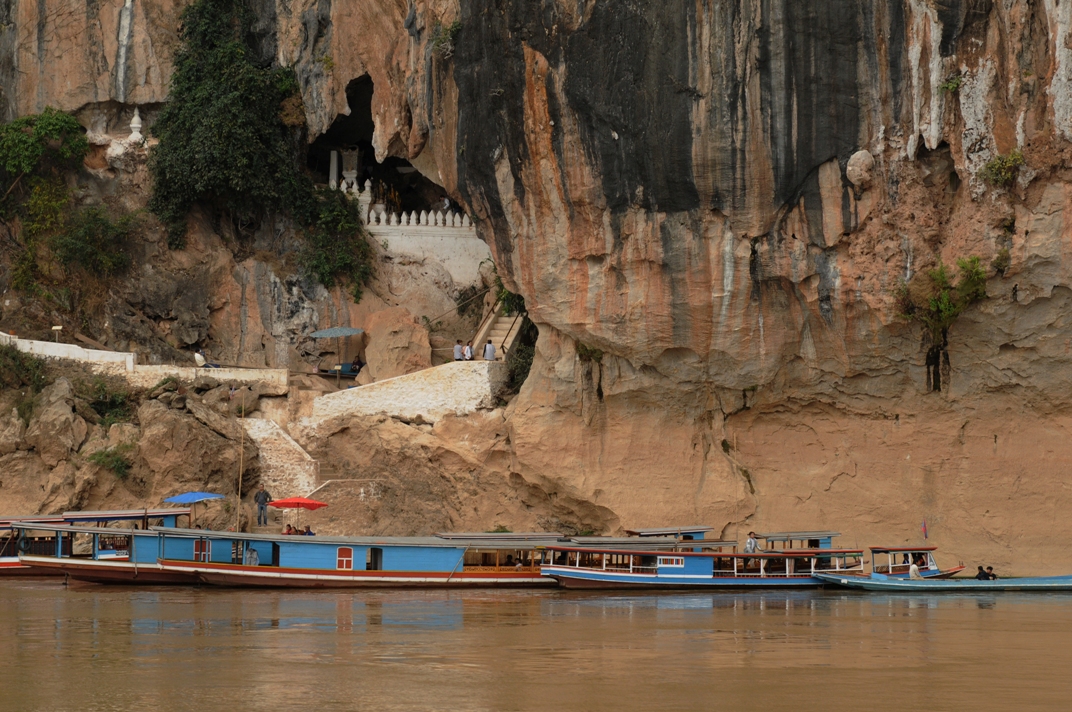
Despite the International Laos Conference in Geneva in 1962, at which the country was granted neutrality, military supplies for the Viet Cong in South Vietnam during the Indochina War passed through Laotian territory along the so-called Ho Chi Minh Trail. Heavy bombing by the U.S. Air Force was the result. The CIA inflicted death and devastation on Laos on an unbelievable scale during the Vietnam War (1965 – 1975); the Americans bombed Laos with over two million tons (fragmentation and napalm bombs as well as the nerve agent „Agent Orange“). More bombs fell on Laos than on Germany and Japan combined in World War 2. Nevertheless, the GI’s did not find the Ho Chi Mingh Trail. The peace-loving Laotians have a 200-year history of conflict with foreign aggressors. Every year, hundreds of people are seriously injured by mines. Defusing squads, mostly women, still search the ground for bombs. The city of Luang Prabang was largely spared the fighting, although units of the communist Pathet Lao organization entrenched themselves north of the city in the Pak-Ou Caves area. In 1975, communist units captured the city.
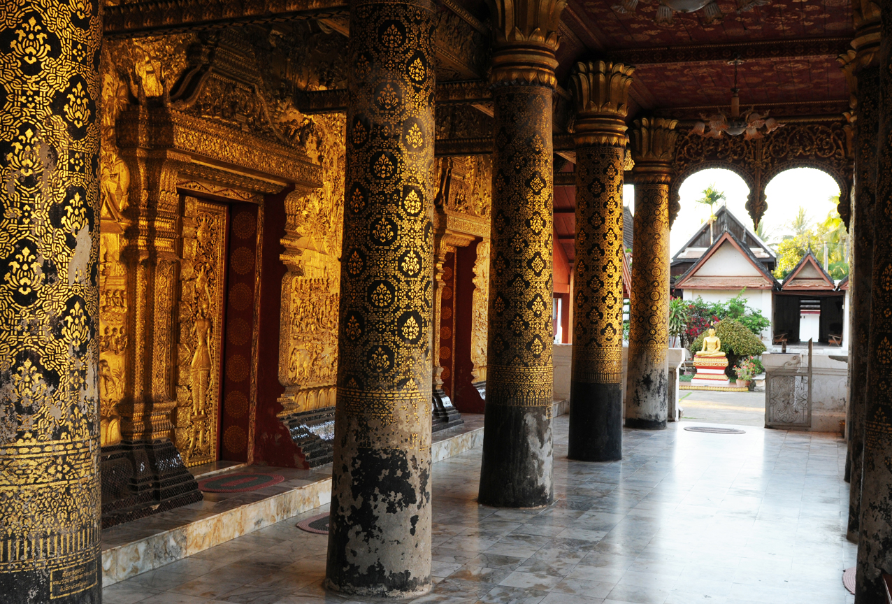
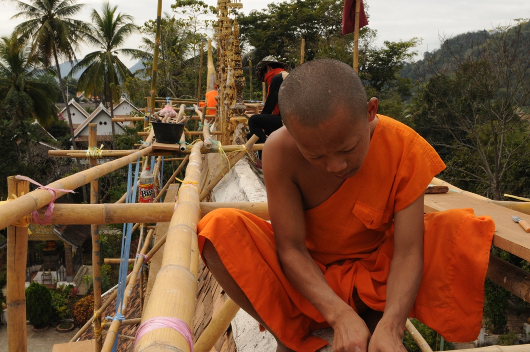
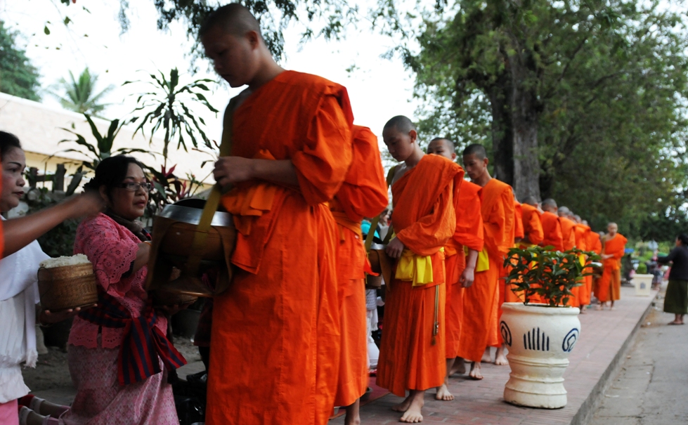
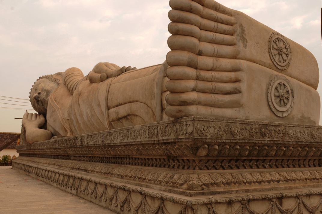
Luang Brabang is home to over 2500 monks who make pilgrimages through the streets of Luang Prabang every morning shortly after sunrise in their orange robes, taking mild offerings in their pots from the faithful and tourists. Mostly elderly women and tourists, let the procession of monks pass by kneeling and donating to each a handful of rice, some fruits, candies, a few banknotes or other things to live on. What cultural sites and religious treasures are there to discover here? First, there is the Royal Palace (Ho Kham), built between 1904 and 1909, now the National Museum, where the throne of the rulers of the Lan Chang period stand. Then the Vat Xienthong (also Wat Xieng Thong) – a temple complex on the Mekong River, built in 1560 under King Setthathirath and restored in 1960-1962. It was the only temple in the city to survive the looting of 1887 intact. The architectural style with the roof reaching almost to the ground is typical for northern Laos.
A gem is also Vat Visounarath (also called Wat Visoun or Wat Visounarath) is a temple complex located on the southeastern side of Phousi Mountain. King Visounarath founded the monastery in 1512, which was destroyed by Chinese hordes in 1887. Most of the complex was rebuilt in the 20th century. The sim (Lao term for the main building of a wat)from 1898 contains Khmer-style window columns. Inside, since 1942, there is a museum with numerous Buddah statues especially in the rain calling gesture typical of Luang Prabang (standing with overlong arms pointing down parallel to the body).
In addition, there are two other temples: That Makmo (the Watermelon Stupa) donated by Phantin Xieng, the wife of King Visounarath, in 1504, the stupa was rebuilt in 1932, with the precious grave goods transferred to the royal palace. And the Vat Sop stupa in the northeast of the old city, founded as early as 1480 as the funeral temple of King Chakkrapat. Behind Vat Sop, on the street called Thanon Vat Sop, there is a typical Lao Baan residential quarter, where you can get an impression of the everyday life of the locals. Last but not least: Mount Phousi (130 meters high, 328 steps), the topographic accent and spiritual center opposite the Royal Palace with a magnificent view of the city area, the Mekong River as well as the forested mountain landscape in the surrounding area. Then head to the night market at the foot of Phousi in Thanon Sisavangvong, the main street of the old city, handmade textiles, sou-venirs and food are offered daily between the Royal Palace and the cross street Thanon Setthathirat from 6 pm. Many of the women traders belong to the Hmong people, who are known for their high-quality weaving, embroidery and sewing.
In Laos, beyond Theravada Buddhism, there is also ancestor worship and animism, which are still widespread among the many ethnic minorities (Hmong, Khmu, Akha or Lanten) in the mountainous regions in the inadequate north bordering China and Burma. The Hmong, for example, are archaically structured opium clans with magical spirit worlds and mythical powers, who to this day believe in their spirit world, with which they have a lively connection through their opium and canabis consumption. The opium farmers live in the isolated highlands of the Golden Triangle completely self-sufficient and reject any government, as well as modern living structures to this day. They live in dark huts without electricity or heating in the most remote highland regions of Laos, as they did hundreds of years ago, and engage in skirmishes with Laotian government soldiers. But the latter are just as unable to secure the Laotian border as the Vietnamese allies, who engage in skirmishes with the Chinese. The Chinese often get the short end of the stick and are said to have three times as many casualties. The Thais also repeatedly tried to invade Laos and were repulsed by the Vietnamese. Since the generals in Hanoi made it clear to Bankok that they would advance right up to Bankok next time, there has been calm on this front.
The Hmong allied with the Americans in the Vietnam War and supplied the CIA with thousands of tons of raw opium annually for their costly war. Rumor has it that the CIA packed 150,000 tons of raw opium per year into empty ammunition crates and flew them directly to Mexico on the doorstep of the United States using Air America pilots and private charters from the Corsican mafia in Laos, which was heavily involved in the international drug trade. The CIA thus not only financed its dirty war, which cost a billion dollars a day toward its end, but also fueled the opium trade and drug consumption of quite a few U.S. citizens and Mexicans. The irony of history: The top Hmong general lived in Washington and enjoyed the protection of the U.S. government, otherwise he would have long since landed in The Hague. The Hmong exodus has resulted in over 150,000 U.S. emigrants in San Diego. Furthermore, many Hmong also live in French Guiana and are therefore Europeans with French passports.
Laos magical Mekong meander and the 4000 islands.
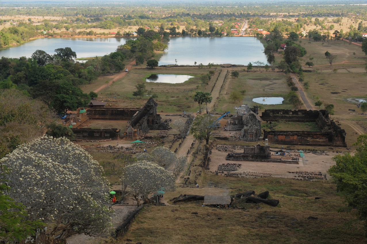
Afterwards, we will descend by plane from Luang Brabang to the commercial metropolis of Pakse in the south of the country, where the second part of the river journey in the Mekong Delta begins. Here the river landscape looks quite different. Wide river streams, flat land mostly overgrown with rice paddies or sand islands and here and there extensive hill ranges far away on the horizon. The trip is very leisurely and more focused on the life on board. You sunbathe on deck and read a book or listen to music and let the world just glide by. That was then the less exciting but all the more leisurely and relaxing river trip. But also here in the south there is a large temple complex called Vat Phou. However, it is a temple complex built by the Khmer. Not quite as impressive as Ankor Wat in Siam Reap, the capital of Cambodia, which I also visited and was impressed by the colossal Khmer cultural strongholds.
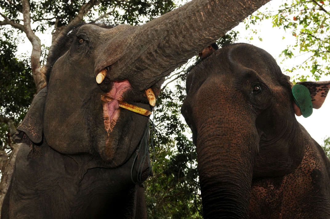
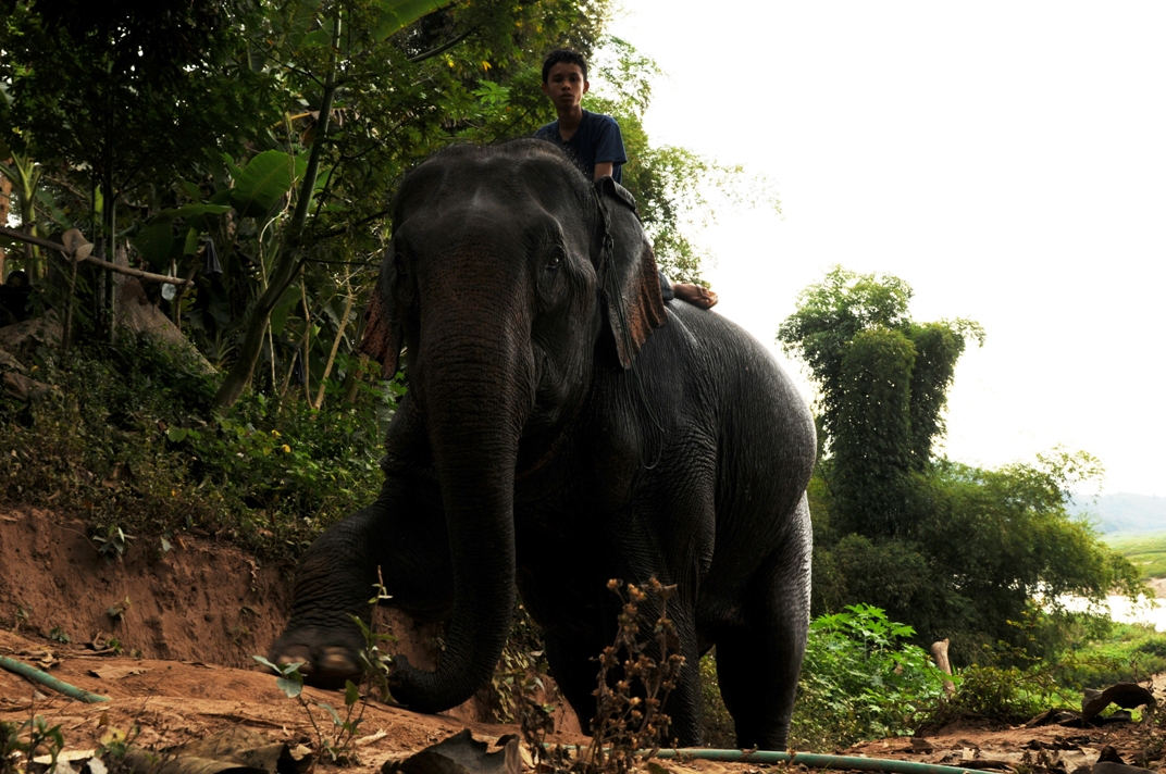
But in the morning we are greeted by elephants taking a dip in the Mekong River. Before they either set off on a tourist safari, silently stalking through the dense jungle along the impressive river landscape, carrying enthusiastic backpackers on their backs, or are needed for work assignments around the village. They are the strongest builders‘ helpers, replacing the crane and the tractor. Under the shouts of the Mahuds, the elephants skillfully pile up the huge logs that they had previously placed in the right position.
In Laos there are also still numerous wild elephants in the inaccessible regions of the north. To this day, between 40 and 60 new species of animals are also discovered there every year. A new species of deer and the largest spider in the world are also among the most amazing discoveries. Unfortunately, due to the destruction of the habitat of flora and fauna, a large number of animal and plant species are threatened with extinction here as well. In 1996, 68 species of mammals, birds reptiles and fish were considered endangered. However, about 14% of the territory is now protected. Forests are threatened primarily by logging, clearing for arable land, and fuel production, with about 8% of the country’s energy needs met by wood. Annual forest loss is estimated at about 300,000 hectares.
Another tourist highlight is the picturesque karst and river landscape around Vang Vien. The Boracay of Indochina, where backpackers get high on grass and opium, is halfway to Laos‘ capital Vientiane, which like Luang Brabang is known as the city of a thousand temples. Here, the sacred That Luang stupa with its chunky gold-plated tower towers above all other religious structures, while on the lowlands near Pakse, Laos‘ economic center, the intricate ruins of ancient Khmer temples can be seen at Vat Phou, the largest Khmer complex outside Cambodia.
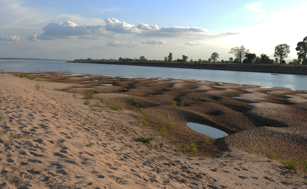
In the lowlands of the Mekong near Pakse, where the Mekong Islands await their guests, lie the 4000 tropical islands on the lower reaches of the Mekong. On the largest of them live 30,000 Laotians, who intensively use the fertile alluvial soil for agriculture and also engage in lively fishing. Rice cultivation, fishing and agribusiness have been the most important resources of the country, from which the lowland Laotians have lived quite well. On the smallest Mekong islands and alluvial dunes, on the other hand, there is hardly room for two herons or a palm tree. The Mekong River has already reached a considerable width here and fans out into a wide delta.
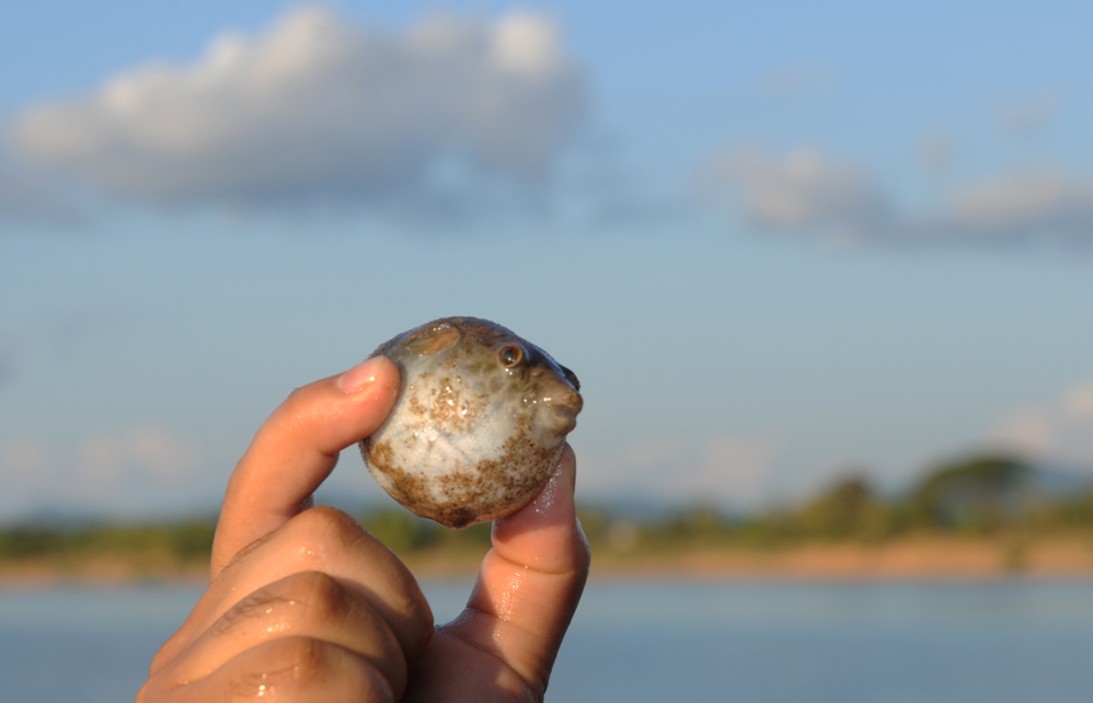
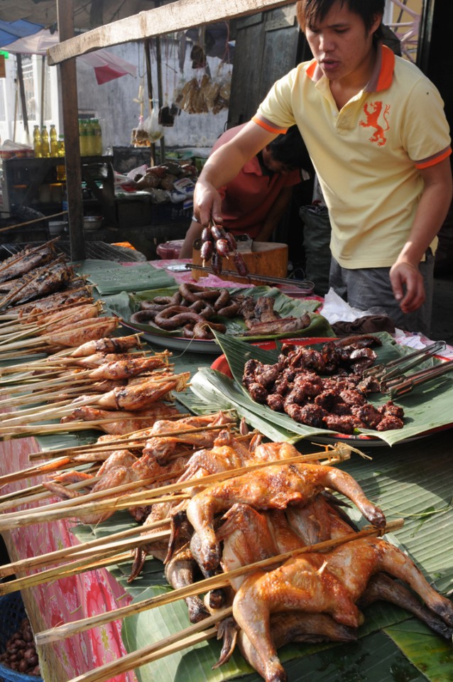
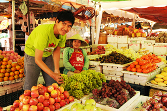
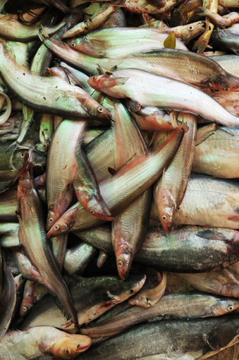
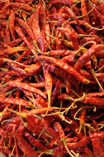
So it is no wonder that the market of Pakse, the largest goods transfer point in all of Indochina is. It is unbelievable what there is to see and taste here. Gigantic the abundance and mountains of rice, vegetables, salads, spices, fruits and fine fresh Mekong fish. There are thousands of frogs jumping around in bowls, there are grilled rats and snakes, small puffer fish and all kinds of other specialties. You, dear reader, should see this with your own eyes. After a side trip to the KuangSi waterfalls, we return to the capital of Laos, Vientianne.
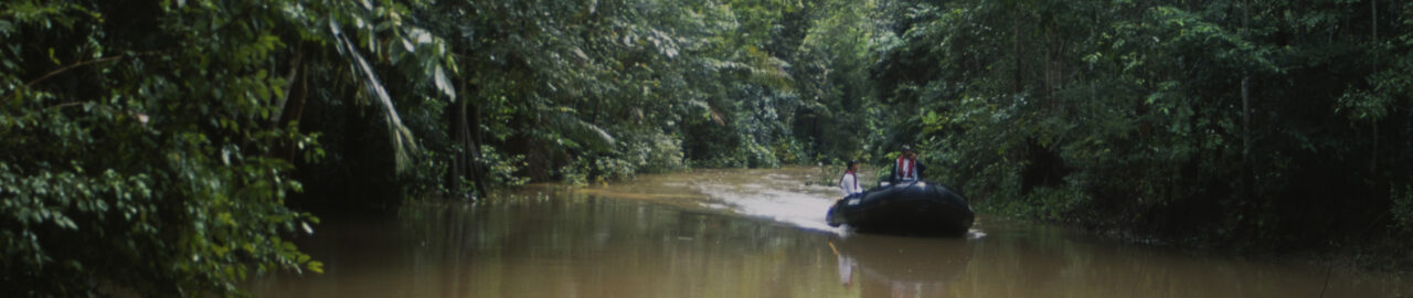
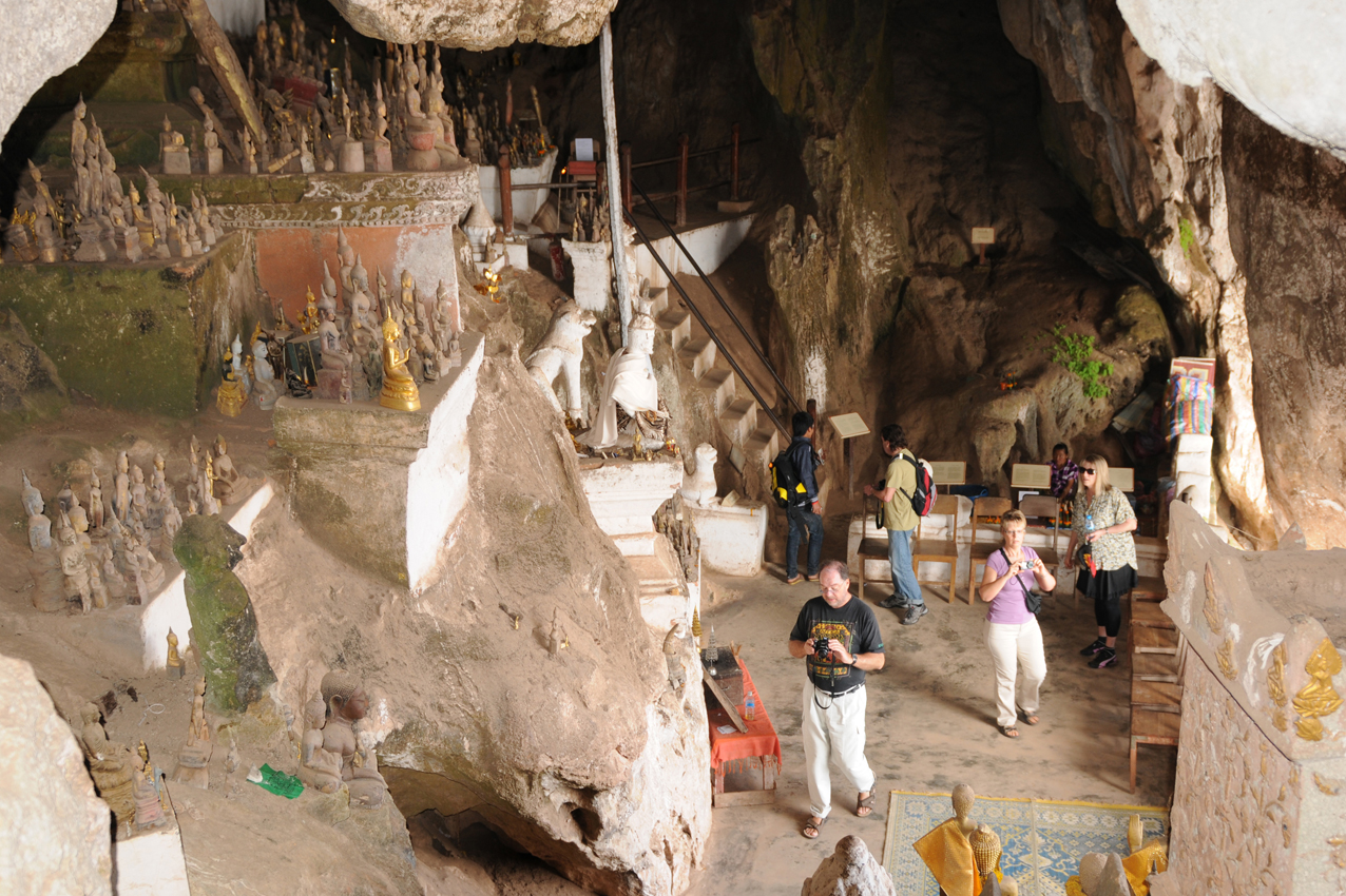
Mekong Cruise to Pak Ou Caves near Luang Brabang City
Cave full with thousands of buddahs. Nordlaos: Pak Ou Höhlen mit tausenden von Buddhas.
The Mekong river in North Laos is quiet dangerous at low water level in the dry season
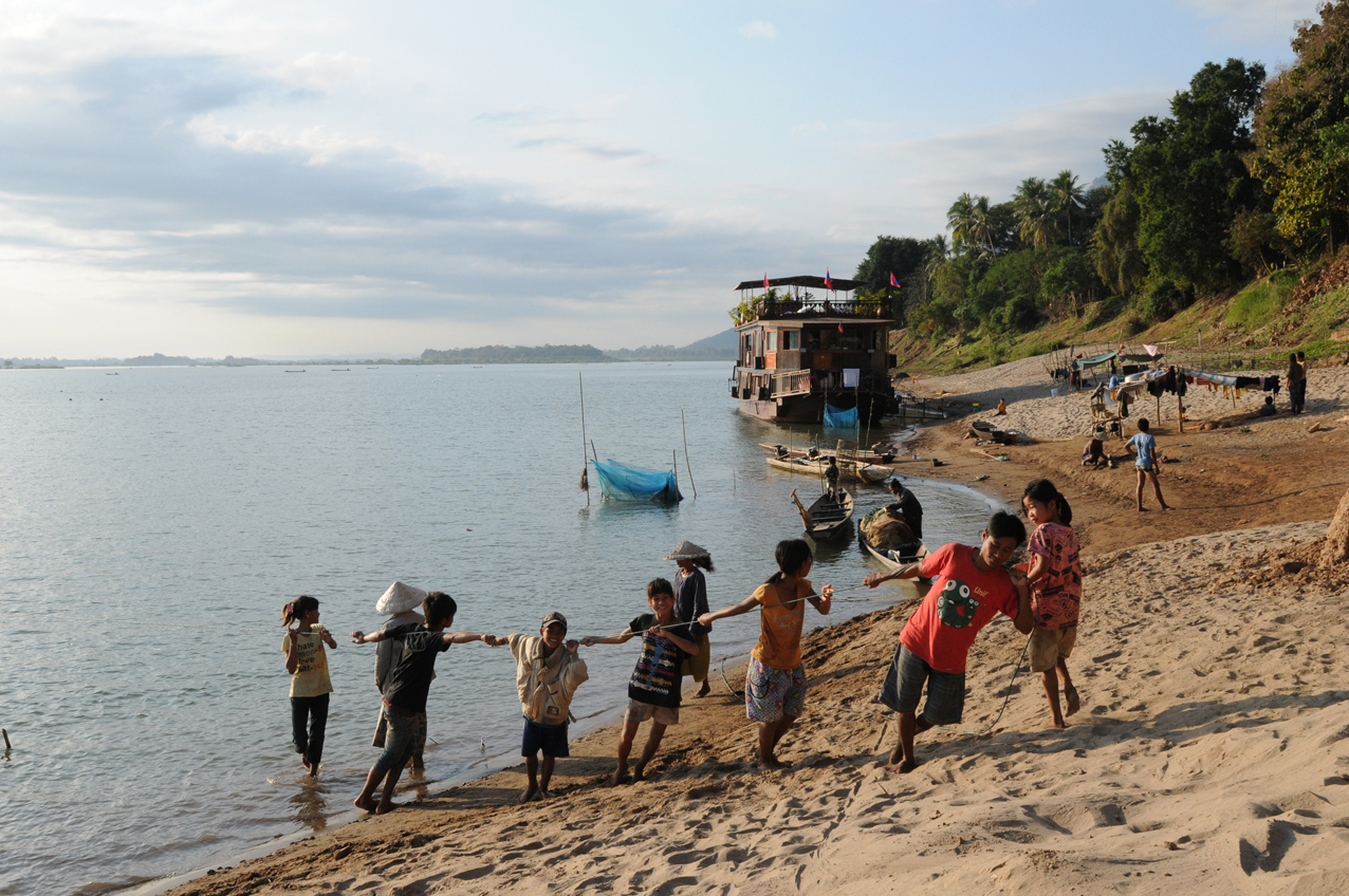
Mekong cuise trip through the 4000 Mekong Islands in the delta
Old buddhist monastry in Luang Prabang City.
Restaurant in Luang Prabang at the mekong river.
Khmer temples Vat Phou near Pakse
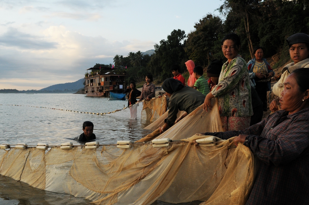
Laos: Fisher men at the Mekong River near Champasak
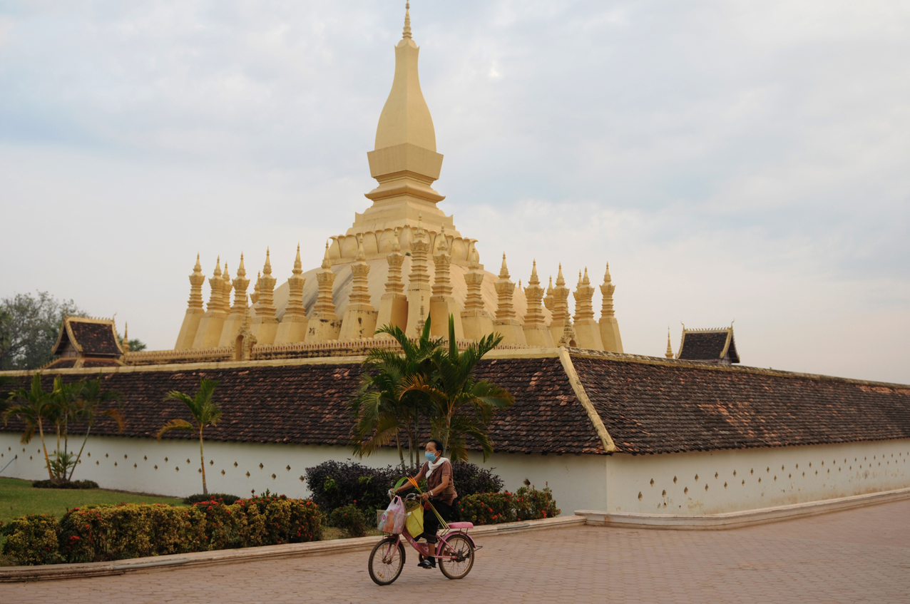
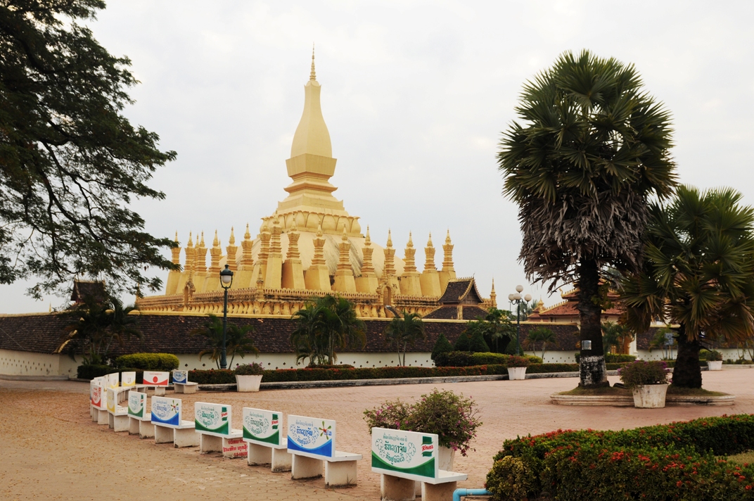
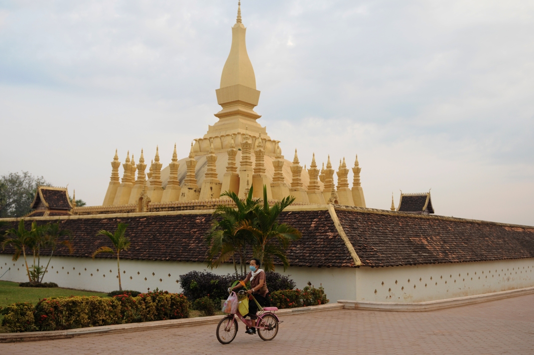
The memorial of king Nokeo Kumane in front of the holy buddhist Stupa That Luang in Viantiane
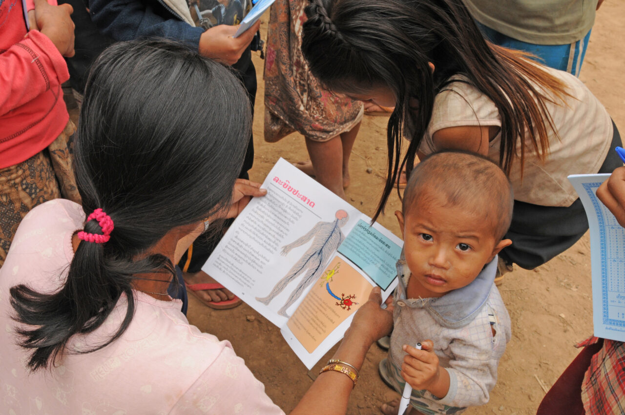
A poor mother with her young boy in Ban Huay Daue Village